Highlighting the latest batch of holes is no. 47, which intersected 71 metres of 3.41 grams gold and 41.2 grams silver per tonne, starting from a down-hole depth of 31 metres. This interval included a 6-metre bonanza-grade intercept of 29.9 grams gold and 234.5 grams silver from 32 to 38 metres down-hole.
Hole 47, along with 38, 48 and 52, have extended the Main zone by 100 metres to the southwest. Hole 52, the most southwesterly hole drilled to date on the Main zone, intersected a 143-metre interval of 0.8 gram gold and 11.7 grams silver (including 25 metres of 2.2 grams gold and 40.6 grams silver), starting at a down-hole depth of 21 metres.
Hole 48 hit 36 metres of 1.58 grams gold and 39.6 grams silver beginning at 61 metres down-hole, whereas previously reported hole 38 intersected 54 metres of 1.64 grams gold and 4.5 grams silver from 27 to 81 metres of depth. The Main zone now extends 500 metres along strike, as much as 300 metres downdip and averages 30-40 metres in thickness.
Holes 49-51 tested the updip portion of the south-plunging block, close to the northwestern limit. Hole 49 cut 27 metres of 0.94 gram gold and 10.4 grams silver; hole 50 pulled 35 metres of 1.07 grams gold and 4.2 grams silver; and hole 51 intersected 10 metres of 0.93 gram gold and 7.2 grams silver.
Francisco says the latest results suggest that the Main horizon thickens to the west-southwest under younger volcanic cover. The junior is waiting for the rainy season to end before it resumes drilling in the fall. A follow-up induced-polarization (IP) and resistivity geophysical survey will be carried out in the next month on a 600-by-1,200-metre grid over the projected southwest extension of the Main zone. The company has found that there is a strong correlation between gold/silver-bearing silica-rich zones and high-resistivity anomalies.
The Marlin property, which lies 140 km northwest of Guatemala City and 60 km from the Mexican border, is accessible by a series of dirt roads from the town of Huehuetenango, some 65 km to the northeast. Marlin is part of a package of concessions totalling nearly 6,000 sq. km. This land package covers the intersection of a young volcanic arc and a large continental-scale fault system. Landsat (land satellite) remote-sensing shows a distinct coincident iron-oxide/hydroxyl/silica enrichment associated with the property.
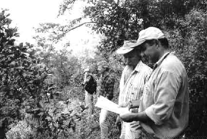
Gold-silver mineralization was originally identified at Marlin in late 1999, following two years of regional reconnaissance and grassroots exploration. Precious metal mineralization was discovered in a roadcut along the crest of an east-west-trending ridge, at elevations of 2,200-2,300 metres. On either side of the gossanous outcrop, now known as the Main zone, the ground drops off steeply to the north and south, providing a vertical relief of 50-100 metres.
The Main zone is a low-sulphidation, epithermal system hosted in Tertiary volcanic and volcaniclastic rocks. The main “Marlin complex” comprises a series of massive-to-fragmental pyroclastic rocks, which host a large part of the Main zone’s high-grade mineralization. An underlying volcaniclastic sequence is composed of conglomerate-to-fine sandstone-siltstone rocks that can also host low-grade mineralization.
The structural controls on mineralization are related to pre-mineral and post-mineral faults. A gently south-dipping thrust fault contact exists between the Marlin complex and the underlying volcaniclastic sequence. The system appears to be controlled by a series of stacked thrust faults.
These structures trend roughly east-west and are often associated with porphyritic andesite dykes. Gold-silver mineralization on the Marlin property occurs in a broad, east-west-trending zone of structurally controlled, argillic alteration enclosing spatially restricted zones of silicification. The silicified zones often coincide with areas of high vein density and abundant quartz stockworks and breccias.
In the Main zone, precious metal mineralization occurs in a dense network of northeast- and northwest-striking quartz veins, and in abundant zones of quartz stockworks and breccias.
Preliminary metallurgical bottle-roll tests on six composite high-grade trench samples showed recoveries of more than 90% for gold and 85% for silver. Francisco is sending drill core rejects from several oxide domains to McClelland Labs of Reno, Nev., for further metallurgical testing and mineralogical studies.
Don Tello
About 200 metres south of the Main zone lies the Don Tello prospect, a northeast-trending structural corridor that has been traced by mapping and surface sampling for more than 1,200 metres of strike length. It is dominated by a central, high-grade, quartz-calcite vein and marginal stockwork zones. The zone dips steeply to the north and extends to widths of up to 25 metres.
Francisco tested the Don Tello corridor with six widely spaced holes during the recent campaign. Results from two of the most recent holes (drilled in the southwestern end of the corridor) included 15 metres of 1.99 grams gold and 21.8 grams silver in hole 45; and 15 metres of 0.7 gram gold and 6.2 grams silver in hole 46.
During the spring, regional stream-sediment and grid soil sampling turned up four new targets within a 12-sq.-km area surrounding the Main zone. All four anomalies are associated with strong argillic and quartz alteration, and have a northeasterly structural fabric.
Field crews have been systematically exploring Francisco’s 6,000-sq.-km land position, identifying several targets in the process. The most advanced of these is La Cienga, 14 km east of Marlin. Geological mapping and surface sampling have identified several broad zones of high-sulphidation, epithermal gold-silver mineralization. The mineralized zones are associated with strongly silicified volcanic breccias and conglomerates, which are intermittently exposed along a 2,500-by-500-metre corridor. Some 215 chip samples from the area averaged 15 grams silver, with gold values of up to 3.5 grams.
An IP-resistivity survey, now under way, has partially defined what is described as a “significant, downdip, high-resistivity anomaly.” La Cienga will be advanced to the drill-ready stage by late fall.
Be the first to comment on "Francisco expands Guatemalan find (August 13, 2001)"