SITE VISIT
ARMSTRONG, ONT.–If there is one character trait that a geologist must have, it is perseverance, and Matt Rees, chief geologist of Linear Metals (LRM-T, LMTCF-O), certainly possesses this quality. Without determination, he would not have managed to define a large molybdenum- mineralized zone here, north of Lake Nipigon, in northwestern Ontario. Having explored and drilled the property since 2002, he feels he knows pretty well what Linear Metals has at its KM61 property: a large project with at least tens of millions of tonnes of material at or near surface, typically grading 0.05-0.07% molybdenum.
Linear Metals describes the project as a porphyry system, with disseminated and stockwork-hosted molybdenum mineralization. The mineralized zone has a strike length of about 1,500-1,600 metres, width of 300-350 metres, and typical thicknesses of 100 to 300 metres. Bordering the higher-grade zones, there are zones up to 150 metres wide, with molybdenum grading less than 0.04%. Some of the mineralization is open at depth, and Linear is drilling three deep holes (600 metres each) to test depth extension.
Outcrop at the KM61 project, named so for its location, 61 km by road east-northeast of Armstrong, was discovered in 2002 by Stephen and Michael Stares. Since then, Rees has been involved with the project, proceeding through several rounds of exploration, until the mineralization could be defined. A National Instrument 43-101 resource estimate is due out this year, with a scoping study to follow in 2009.
The project was optioned to Noranda (later Falconbridge) in 2003, until it was returned to Linear Metals in 2006. Noranda-Falconbridge tested a 1,200 by 600-metre block, drilling 3,200 metres. Linear drilled another 4,000 metres, followed by a 25,000-metre program, which is close to completion. The combined total of 32,000-33,000 metres of drilling in 105 holes gives Linear a firm grasp on the project.
The property is located in the Caribou greenstone belt. A southwest portion of the belt wraps around a northwest end of a large composite felsic pluton in the property area. The property covers a 1 km by 7 km lensoid-shaped contact zone between the pluton to the south and metabasalts to the north.
The disseminated and vein-type molybdenite-chalcopyrite mineralization here is hosted by two northeast- trending, quartz monzonite porphyry dyke swarms and their flanking mafic metavolcanics. These porphyries and their wall rocks host extensive stockworking with quartz and quartz-sulphide veins, and host-disseminated chalcopyrite and molybdenite.
Rees says that the property holds two types of rock: porphyries and mafic volcanics. Mineralization occurs in the quartz vein stockwork and disseminated in both rock types. “The quartz vein stockwork is really the key,” Rees says. “Usually the quartz veins are not as big in the porphyry as they are in the mafics.”
Linear is looking for several minerals, including molybdenite and chalcopyrite, which holds copper and silver. Prominent solid veins with bluish metallic-looking molybdenite mineralization are visible in some of the drill core, and Rees knows from previous holes that these will have high grades of moly, around 0.1%, and sometimes higher.
Rees says that the mineralization is associated with alteration.
“The key to the mineralization is the stockworking, but biotite alteration seems to be a prominent feature of the mineralization,” he says. “The sericite concentrates mostly in the felsic phases in the porphyries, while the biotite can occur in both mafic volcanics and porphyries. The biotite seems to be the most critical.”
Rees says that the mafic volcanics can also have actinolite alteration.
The mineralized zone, known as the main zone, has two extensions: the northeast extension and the southwest zone. The combined strike length of the three zones is about 1,600 metres and still partially open to the northeast. Within the strike length, there is a 100-metre section where mineralization has yet to be confirmed. In addition, the eastern half of the main zone and the entirety of the northeast extension are open at depth. In the centre of the main zone, two individual drill holes returned intersections totalling 300 metres (sum of several intersections) at an average grade higher than 0.05% molybdenum, plus silver and copper. Mineralization starts at or near surface.
Examples of long intersections highlighted bythe company include hole 85, cutting about 297 metres cumulative thickness (the sum of seven intersections) of 0.061% molybdenum, 0.1% copper and 2.5 grams silver per tonne; hole 83, which intersected about 313 metres cumulative thickness (the sum of four intersections) of 0.051% molybdenum, 0.09% copper and 2.8 grams silver; and hole 84, which returned 251 metres cumulative thickness (the sum of five intersections) of 0.07% molybdenum, 0.1% copper and 2.5 grams silver.
Not all holes intersected mineralization over such lengths. For example, hole 76 returned about 103 metres cumulative thickness (the sum of three intersections) of 0.064% molybdenum, 0.08% copper and 2 grams silver; and hole 82 returned about 102 metres (in one intersection) of 0.053% molybdenum, 0.09% copper and 2.9 grams silver per tonne. Meanwhile, hole 79 returned only 8 metres of mineralization.
Previous drilling on the main zone also returned shorter intercepts. In early July, the company highlighted five holes with intersections of 90 metres to 206 metres cumulative thicknesses, grading 0.061-0.079% molybdenum, plus copper and silver.
In addition to the long 0.05-0.07% molybdenum intercepts typical of the main zone, there are also five zones that returned short intercepts (10 to 50 metres) of about 0.1% molybdenum at or near surface (50- 70 metres depth). Linear’s president, Brian MacEachen, says that these high-grade areas should be mined first, to enhance project economics.
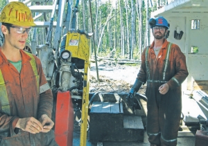
During The Northern Miner’s recent site visit it was evident how near-surface the rock is. There are a number of outcrops, and shallow trenching can uncover the rock elsewhere. Besides assaying, initial metallurgical test work is also in progress, and moly recoveries will be reported once tests are completed.
Linear Metals holds a 100% interest in KM61, subject to a 0.5% net smelter return (NSR) royalty, half of which can be purchased for $250,000. Other areas of the property are subject to a 3% NSR royalty.
On a 10.5 by 7.5-km land package, Linear’s claims total 48 sq. km, and they cover a number of other prospective targets that the company is investigating. The three highest priority targets were discovered during an airborne geophysics survey using resistivity and induced polarization. Rees is looking for molybdenum in lake sediments, and one indication of possible mineralization is the presence of potassium-thorium anomalies, which may point to biotite or sericite alteration, and potentially porphyry rock. So far, Linear has discovered two potassium-thorium anomalies for follow up.
Road and rail infrastructure in the area is good. A paved road, highway 527, leads from Thunder Bay north to the small town of Armstrong, a distance of about 250 km. Jackfish Road, an unpaved logging road, leads east-northeast from Armstrong, and a short bush road leads to the project from Jackfish Road. A 12-km logging road connects the project with the main CN railway line.
Currently there is no electric power in the area. However, the company says that Ontario Power Generation is planning to construct a generating station on the Jackfish River, scheduled for completion in 2014. This would make power available within 10 km of the property. Should the project go into production earlier, diesel generators would have to be used.
The company rents space from the McKenzie Lake Inn, a few kilo-metres south of Armstrong on highway 527, and uses it as a base. The facility has accommodation, two saw shacks, two logging shacks, a
nd core storage. Basic provisions, including fuel, are available at Armstrong, but any other supplies must be brought from Thunder Bay. A drillers’ camp, with mobile homes and a diesel generator, is located next to the project.
Linear has signed a memorandum of understanding with the Whitesand Ojibway First Nation, located near Armstrong. It also employs First Nations people on the project.
Aside from KM61, Linear holds the Cobre Grande polymetallic project in Oaxaca state, Mexico; a scoping study on the project is expected next year.
There is about $4 million in Linear’s treasury, and the company has 46.8 million shares fully diluted.
Be the first to comment on "Linear drills KM61 moly discovery"